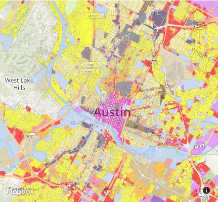
 The City of Austin has released its zoning comparison maps for the proposed update of the Land Development Code. The new map designates areas of neighborhoods for more walkability, increased public transit, and automobile-dependent areas.
The new zoning map has added categories to provide more specifically regulated areas such as:
- T3, T4, and T5 Neighborhood – large lot widths with varied setback distances
- T3, T4, and T5 Main Street – including retail, service, and residential uses in compact, walkable urban forms
- T5 and T6 Urban – compact, high-density walkable urban environment that provides urban housing choices as well as a wide range of regional-center appropriate uses such as employment, retail, services, entertainment, civic, and public uses
It also renames/redefines some existing categories:

For further information, review the proposed Land Development Code text, and comment here: httpss://codenext.civicomment.org/
The comparison maps can be found here: https://codenext.engagingplans.org/codenext-comparison-map